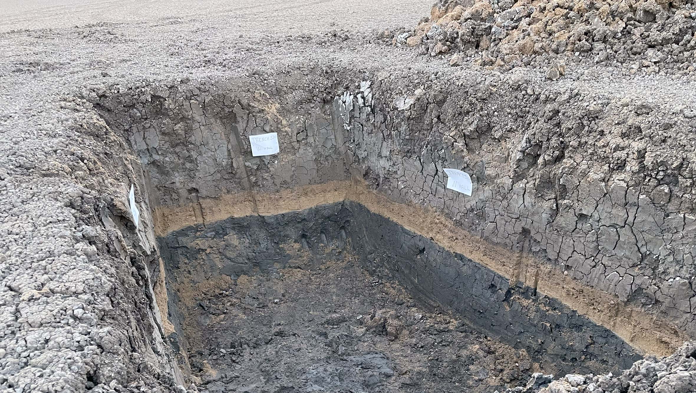
 The CE 365 paleotsunami deposit as recorded along the coast of SE Sicily, Italy (800 km far from the causative source in Crete, Greece)
About the Dataset
This database collects scientific data on paleotsunami deposits in the Euro-Mediterranean area. It aims to provide crucial information for tsunami hazard assessment and the development of inundation scenarios.
The data includes information on the location, stratigraphic characteristics, and dating of the deposits, offering a long-term view of the frequency and impact of tsunamis in the region. The first dataset included was produced in the framework of the EU-FP7 ASTARTE project.
Open Data Access (OGC WFS)
The dataset is freely accessible via standard OGC (Web Feature Service). You can download the complete data in various formats or connect directly using GIS software.
 The dataset is released under the Creative Commons Attribution 4.0 (CC BY 4.0) license. You are free to share and adapt the material for any purpose, provided you give appropriate credit.
Download the Full Dataset:
⬇️ Download CSV ⬇️ Download GeoJSON ⬇️ Download ShapefileFor GIS Software (e.g., QGIS, ArcGIS):
Use the following URL to add the WFS service to your GIS project:
https://services.tsunamidata.org/PALEOTSUNAMI/ows?service=WFS&request=GetCapabilities
How to Cite
If you use this dataset in your research, please cite it as follows:
De Martini, P. M., et al. (2017). The ASTARTE Paleotsunami Deposits data base-a web-based reference. Istituto Nazionale di Geofisica e Vulcanologia. https://doi.org/10.13127/tsunami/paleodeposits
Legacy landing page
If you are looking for the legacy landing page hosted in ArcGIS Online, please, use the following link.